Motivation#
Now that you are familiar with the basics of Python programming and data analysis using the pandas library, it is time to apply those skills to geographic data analysis. In this part of the book, you will learn how to handle spatial data using Python and various libraries that have been developed for geographic data analysis.
Why to use Python for geographic data analysis?#
Python is an extremely useful language to learn if you are interested in geographic data analysis (“GIS analysis”) and geographic information systems (GIS). Many (if not most) of the various GIS software (such as ArcGIS, QGIS, PostGIS etc.) provide an interface to conduct analysis using Python scripting. In this book, we will focus on doing geoprocessing and geographic data analysis without any third party software. Why? There are several reasons for doing GIS using Python without any additional software:
Python has an extensive ecosystem of libraries and tools for GIS: you can do almost anything with spatial data. In fact, there is an enormous geospatial industry that is heavily relying on open source Python libraries.
Python GIS libraries are easy to learn: there are tons of good and free resources available to learn doing GIS analysis with Python for free (the online version of this book is one example!).
Python is highly efficient: used for analysing big (and small) geospatial data.
Python is highly flexible: supports hundreds of spatial data formats (most likely many which you, or us, have never heard of).
Python allows to mix and match various libraries: You can combine different libraries and methodological approaches together and create sophisticated analytical pipelines.
Everything is free: you don’t need to buy a license for using the tools.
You will learn and understand more deeply how different geoprocessing operations work.
By using Python’s open source libraries and codes, you support open science by making it possible for everyone to reproduce your work, free-of-charge.
You can plug-in and chain different third-party software (not necessarily written in Python) which allow you to build e.g. fancy web-GIS applications (using e.g. KeplerGL, Dask or GeoDjango for developing the user interface and having PostGIS as a back-end database).
Python libraries are developing fast: an active open source community is continuously improving existing libraries, or creating new libraries for tasks that require new tools. However, it is good to be aware that fast development is not necessarily a guarantee of stability or quality. Hence, as for any open source library (with any programming language), it is good to investigate a bit before starting to use a new open source GIS library whether it has been actively maintained and if it seems to have an active developer community.
Core libraries for geographic data analysis in Python#
We have already used a few Python modules for conducting different tasks, such as pandas for doing some basic data analysis tasks or matplotlib for visualizing our data. From now on, we will familiarize ourselves with a bunch of other Python modules that are useful for geographic data analysis. Python has a large ecosystem of libraries that can be used for doing analysis, visualization or geocomputation with spatial data, as shown in Figure 5.1 which shows how different Python geo-oriented libraries (n=145) are linked to each other. There is a dedicated website at ecosystem.pythongis.org [1] that lists and provides useful information for a large set of tools available for doing GIS and Earth Observation (remote sensing) in Python. Naturally, we won’t use all of these packages in this book, but we will explore many of them. Although the ecosystem is broad, there are a few core libraries that are widely used across the ecosystem:
Core vector libraries:
geopandas,pyproj,shapelyCore raster libraries:
xarray,rioxarray,rasterio
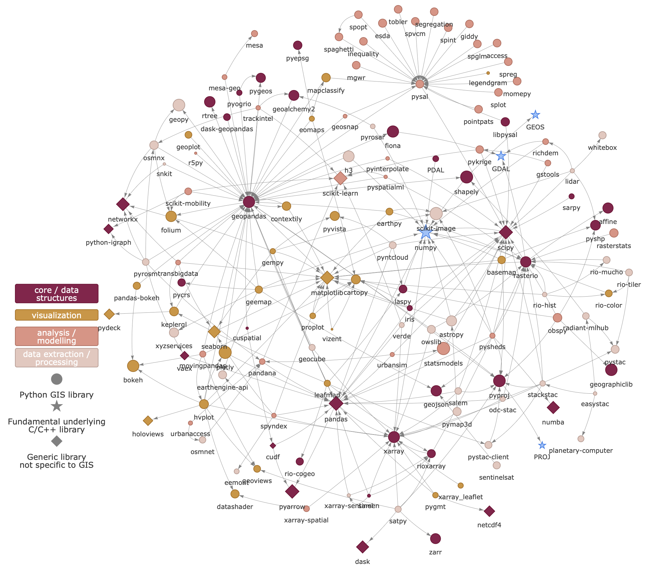
Figure 5.1. Python ecosystem for GIS and Earth Observation (Tenkanen, 2022).
One drawback of such a broad open source ecosystem compared to using a specific GIS software such as ArcGIS, is that open source tools and their documentation are spread under different Python modules and created by different developers. This means that when working you need to familiarize yourself with many different tools and their documentation, whereas in ArcGIS everything is packaged under a same module called arcpy and all the documentation can be found from a single location. However, open source libraries have many other benefits as described earlier.